Showing posts with label Nature. Show all posts

Saturday, February 21, 2026

Iceland: Nature - Coastline

We are back with more news from our upcoming Iceland DLC for Euro Truck Simulator 2! In today's blog, we would like to showcase a preview of the stunning nature you will see in the Land of Fire and Ice, with a focus on its scenic coastline.

Along Iceland's nearly 5,000 kilometres of coastline, you can see where this country got its nickname, as it is literally shaped by fire and ice. Steep cliffs rise above deep fjords carved by glaciers during the last ice age, while black-sand beaches stretch along the shore, formed by centuries of volcanic activity.

Actually, most of the beaches in Iceland are made of black sand. This dark, almost otherworldly look comes from volcanic lava that cooled rapidly when it met the sea, and also from the ocean slowly wearing down the softer rocks above the basalt to create the cliffs we see today. The mainland is dotted with smaller islands and countless rocky outcrops, adding to the rugged feel of the landscape.

One of the most stunning locations featured in this map expansion is Reynisdrangar - an impressive series of rock formations rising from the sea near the shore of the famous black-sand Reynisfjara Beach, close to Iceland's southernmost village, Vík í Mýrdal. These dramatic basalt sea formations are the remnants of large ancient sea cliffs, towering out of the ocean under the steep cliffs of Mt. Reynisfjall.

Although the area is truly breathtaking, visitors should be aware that unexpectedly powerful waves and strong currents frequently occur here and can be dangerous. This part of the coastline is also heavily affected by erosion, adding to both its wild beauty and danger as well.

The northwestern peninsula of Iceland has a name that perfectly reflects its landscape: Vestfirðir, meaning "West Fjords". Here, you can drive along a coastline carved by dozens of fjords - long inlets formed by ancient glaciers that reach far inland. Traveling along Route 60, you'll see breathtaking views of the ocean, dramatic cliffs, and rugged terrain at every turn.

If you're traveling along the Ring Road, be sure to watch for the stunning scenery along the way. One highlight is the southeast coast, where numerous glacial rivers carry sediments to the ocean, creating striking lagoons and sandbars that stretch along the shoreline.

Driving further along the coast, you'll encounter another spectacular sight shaped by Iceland's geological forces - towering cliffs that were once part of the seashelf. Here, the road runs along a shallow shore, with the ocean on one side and these massive cliffs rising on the other.

And that's all for today! If you are eager to be trucking in this upcoming map expansion, don't forget to support us by adding the Iceland DLC to your Steam wishlist.

Also, remember to give our X/TwitterInstagramFacebook, ThreadsBluesky, and TikTok a follow as you'll receive updates not only about Iceland, but also other news from our games straight to your feed. Or subscribe to our newsletter to stay informed! Until next time, we will see you on the road.

Friday, December 5, 2025

Illinois: Prairies and Fields

As work on the Illinois map expansion for American Truck Simulator continues, we’re excited to bring you a first look at the Prairie State’s signature landscapes. Today’s blog showcases the prairies, farmland, and wide-open vistas that define so much of Illinois.

Illinois sits at the heart of the Midwest, combining Great Lakes influences in the north with vast agricultural plains stretching across the center and south. One of the most striking things about driving here is how quickly the scenery opens up. Long, straight highways cut through endless rows of corn and soybeans, with classic red barns, grain silos, and elevated storage facilities appearing regularly on the horizon.

Wind farms are another distinct element of Illinois’ scenery. You’ll spot these modern giants from roads such as the US-20, I-39, and I-55, where lines of turbines sweep across the prairie. These areas will offer great opportunities for scenic screenshots as you travel through the state.

Much of Illinois’ terrain was shaped by ancient glacial movements, resulting in mostly flat landscapes with gentle, rolling variations. Routes like the I-74, US-24, and US-67 pass through a mix of open prairies, subtle hills, and river valleys that add variety to the otherwise expansive fields. As drivers move further south, especially along IL-3, they’ll notice that the terrain becomes more varied with bluffs, low hills, and winding river corridors.

Agriculture is the backbone of Illinois, and more than three-quarters of the state’s land is dedicated to farming. Corn, soybeans, hay, and wheat fields dominate the countryside along I-57, I-72, and many of the rural highways. To represent these iconic landscapes faithfully, our teams have created new prairie grasses, flowering plants, and improved crops that will bring the fields to life in every season.

Forested areas, although less frequent than farmland, are found throughout the state—especially near waterways or in protected natural zones. Expect to see oak savannas, riverbank forests, and lush wooded pockets breaking up the open plains. These areas help diversify the scenery and offer refreshing transitions between long stretches of farmland.

Truckers can also look forward to discovering regional landmarks, small towns, and characteristic Midwestern views throughout Illinois. From expansive wind farms and roadside grain elevators to scenic prairies and river crossings, there will be plenty of moments to appreciate the state’s natural charm.

If you’re looking forward to hauling freight across Illinois, don’t forget to add this map expansion to your Steam wishlist. And of course, stay connected with us on X/TwitterInstagramFacebookBluesky, and TikTokosubscribe to our newsletter for more updates. Keep on truckin', and we’ll see you on the road!

Tuesday, September 23, 2025

South Dakota: Grasslands and Forests

South Dakota is a lovely state, home to diverse landscapes and rich wildlife. Let's take a look at some of the natural locations our map designers are currently recreating for this in-development map expansion for American Truck Simulator.

The Mount Rushmore state is located in the North Central Region of the United States. As you can see on the screenshots from these locations, South Dakota's landscape offers a truly unique driving experience, ranging from vast open plains with far-reaching views across the countryside to rolling hills, lush green forests, fertile fields, and striking rock formations along the roadside.

In the western part of the state, you'll come across a region full of dense forests and distinctive dome-shaped mountains, known as the Black Hills. Several scenic routes wind through this beautiful national park, including US 85, US 385, US 18, and SD-44, which pass through beautiful cities like Sturgis or Hot Springs.

As you head further east, you can take Interstate 90, which runs east to west across the state and passes near the stunning Badlands National Park - just like SD-44.

Next, you'll cross the Missouri River, which flows through the center of South Dakota and divides the state into two. On the eastern side lies the Prairie Plains, a landscape of wide rolling hills, flat river valleys, and vast fields of sunflowers. You will be able to spot these beautiful locations, especially when driving on roads such as SD-34, SD-50, I-90, and US 18, all of which showcase the area's pristine natural beauty.

We hope you liked this preview of South Dakota's wonderful nature, but you can look forward to more, as we will explore the lovely Black Hills and Badlands National Parks in greater detail in our future blog posts!

If you are excited to explore this state's natural beauty, make sure to add the South Dakota DLC to your Steam wishlistAlso, remember to follow us on our TwitterFacebookInstagramBluesky, and YouTube for all the latest news from not only this map expansion, but also other American Truck Simulator projects, or sign up for our newsletter to stay informed. Happy haulin'!

Tuesday, July 15, 2025

Louisiana: Wetlands and Forests

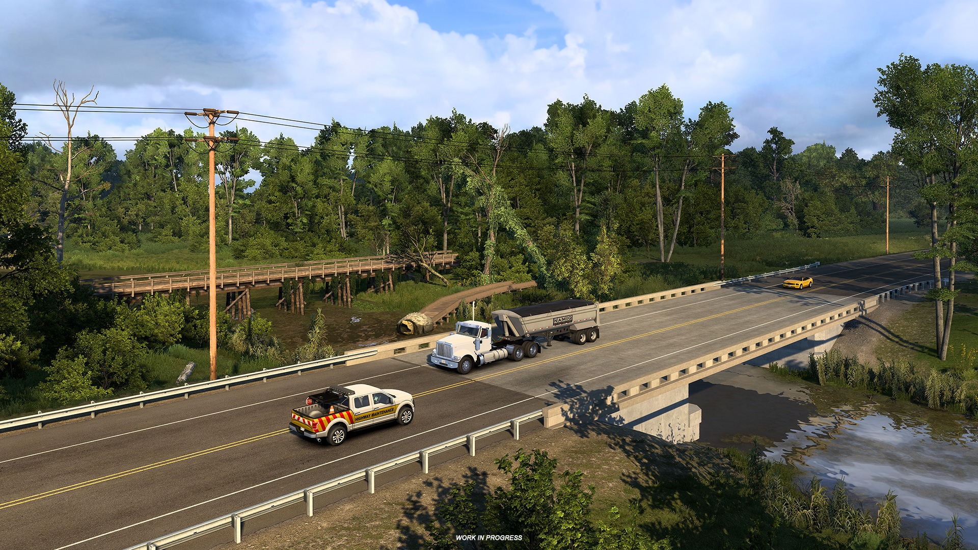
Louisiana's lakes, rivers, swamps, bayous, and forests showcase a remarkable variety of landscapes. Today, we will take a look at the beautiful nature you will find in the Pelican State while on the road in this upcoming map expansion for American Truck Simulator!

Louisiana's warm, subtropical climate, thanks to its location within the Gulf of Mexico, sets the stage for some truly one-of-a-kind scenery. It's a big shift from some of the landscapes in our previous map expansions. The Pelican State's terrain is broadly divided into three distinct regions: dense forests, sweeping prairies, and expansive marshlands, each offering its own unique scenery and atmosphere. The state offers 22 national parks as well as many impeccable nature trails, paddling routes, fishing areas, and more.

The Mississippi River has played a big role in shaping Louisiana's landscape. For thousands of years, it carried huge amounts of dirt and sand from all across the country and slowly built up the southern coastline, pushing it miles out into the Gulf of Mexico. As the river shifted its path over time, it left behind old river branches that slowly sank and wore away, forming the mix of marshes, lakes, and winding bayous that make this area so unique today. You may follow the river upstream if you are traveling U.S. Route 65, which winds along the Mississippi border.

If you want to experience more of the bayou region, head down to the southern coast. From shadowy swamps with cypress trees to sunlit marshes, the bayous are home to unique wildlife, including diverse species of birds and alligators. This area is also vital for harvesting shrimp, oysters, and fish. For a scenic drive through this natural wonder, follow the LA-82.

However, the lowlands are not the only type of landscape found in Louisiana. If you venture further north, you will discover the Red River valley, which has a low-elevation relief and typically features red soil. In the northern part of the state, you will mainly find some rolling hills, which you may come across while driving along I-20.

And that's it for today! Remember to add the Louisiana DLC to your Steam Wishlist and don't forget to give our X/TwitterInstagramFacebookBluesky, and TikTok a follow as you'll receive updates about our games straight to your feed! Osubscribe to our newsletter to stay informed. We look forward to sharing more with you soon.

Wednesday, January 29, 2025

Iowa - Fields & Prairies

We know some of you are very excited about the Iowa map expansion, which is one of our upcoming map DLCs for American Truck Simulator. Now, we can finally reveal more on how the development of this map is going. In this blog, we would like to show you a glimpse of the Hawkeye State's nature!

Located in the upper Midwestern region of the USA, Iowa forms a bridge between the forests of the east and the grasslands of the prairie plains to the west. Saimon, the DLC's map lead, shared his thoughts on the state's nature from the research trip he and his team took in 2023. "The first thing that caught our attention were the expansive hills with terraced fields, picturesque farms with round silos, and countless wind turbines on the horizon."

Iowa also takes special care to protect native flowers and grasses as part of its environmental program. That is why our teams have created a lot of new flower assets that will brighten the countryside of this map.

Iowa's terrain comprising of rolling hills and flat plains was greatly influenced by continental ice sheets that covered it and melted just around 13,000 years ago. Its elevation gradually increases from the southeast to the northwest, though it remains modest, with the highest spot, Hawkeye Point, reaching only 511 meters above sea level.

An important part of the landscape is the Mississippi River which creates the entire eastern border of the Hawkeye State. The vegetation in Iowa is mostly tallgrass prairie and savanna. Actually, over 90 % of its land is used for agriculture, mainly for corn, soy, and hay. This is why Iowa is also called the Corn State, and ranks as number one among the US states in corn and soybean production. So you can look forward to playing an important role in the region's agricultural industry, transporting local produce.

Only 8 % of Iowa's land is covered by forests which can be divided into three categories - upland hardwoods, found in elevated areas with well-drained soils; oak savannah, which is a transition between upland and bottomland forests; and the bottomland hardwoods often found near water bodies with wet soils.

As always, truckers can look forward to encountering some natural landmarks which will be incorporated into the map. One example is the famous Tree in the Road located near I-80 between Omaha and Des Moines.

If you are excited to be trucking in Iowa, don't forget to support us by adding this map expansion to your Steam Wishlist! Until then, make sure to stay up to date on any other news by following us on our social media (TwitterFacebookInstagramTikTok, and YouTube). We'd also really appreciate if you could sign up for our newsletter to stay informed, even when you're not able to check out the blog or our socials.